Saturday, June 8, 2019

Li'l Abner's Steakhouse, Tucson, AZ


One of our favorite places to eat in Tucson is Li'l Abner's Steakhouse.  It is a former stagecoach stop.  The first time we went there was in 2005, the menu consisted of the following: do you want a small steak or a large steak.  That was it, everyone received the same sides.  They cook your steak over an outdoor mesquite grill.  Now they have more choices including ribs.  The meals come with the following sides: Texas toast, beans, and salsa.  They do have other sides your can add to your meal. They have both outdoor or indoor tables.  Good food, fun atmosphere; we give Li'l Abner's four thumbs up.


Outdoor mesquite grill

Remains of stagecoach buildings.

Saguaro National Park, Tucson, AZ

Saguaro National Park, surrounding Tucson, AZ on the east and west sides, is home to the largest and most famous of the cactus species.  These large cacti with their arms reaching toward the sky are an iconic symbol of the southwest.  The park is divided in two sections with scenic roads to drive in both areas of the park.  These cacti only grow naturally in this part of Arizona, from Phoenix to Tucson.  The rocky hills throughout southwestern Arizona are dotted with these majestic Saguaro cacti.


Cholla cactus in foreground, Saguaro cactus in background.


Saguaro cacti grow additional arms in order to balance and not tip off to one side or the other.

Saguaro cacti marching up the hillside.


Mt. Lemmon, near Tucson. AZ

Took an early spring drive up Mt. Lemmon in the Coronado National Forest near Tucson, AZ.  The elevation of Mt. Lemmon is 9157 ft.  There is a ski area located here which receives 200 inches of snow a year.  The drive was beautiful and even though it was in the upper 70s down in the valley, it was in the low 50s at the top of the mountain.  There is a quaint little town located near the top of the mountain called Summer Haven.  The drive includes an area known as the Skyline Scenic Byway.


Mt. Lemmon


Wednesday, June 5, 2019

Colorado National Monument, Fruita. CO

Colorado National Monument is a collection of rocky bluffs and rock spires near the town of Fruita, Co.  We happened to visit in the winter.  The snow made everything look especially beautiful.  We weren't able to drive the whole road because of the snow.  But we were able to go as far as Independence Monument, a skinny rock spire that is so named because every Fourth of July someone climbs to the top and places the American flag on top.  This was first accomplished by John Otto in celebration of his successful efforts to get this area declared a National Monument.


Independence Monument

Balanced Rock

Apache Trail, Arizona

Apache Trail runs from Apache Junction, Arizona to Roosevelt Lake in AZ.  This trail is twisting and turning, up and down including 40 miles of unpaved, dirt road.  It winds down into the canyons and back up the mountain.  The trail winds through the Superstition mountains and past the area where the Lost Dutchman mine is supposedly located, although no one knows exactly where the mine is actually located.  Thus the "lost" part.  The trail passes through a small town called Tortilla Flat.  The town includes a restaurant, a general store and an ice cream shop; what more could you need.  After the town of Tortilla Flat, the pavement ends and the fun begins.  Many people drive this road because of the challenge it presents or the bragging rights...  It is the first adventure that we took in our Jeep.  And we received a rock chip in the window as a souvenir.  The beginning of the trail is somewhat desolate, with desert-like scenery.  The end of the trail, is a series of canyon lakes and then Roosevelt Dam and Lake.  You can continue your trip from there and drive through Globe and then up the mountain passes into the mining town of Superior and then back to Apache Junction where you started.  You will have completed a round trip of 120 miles of breath-taking and diverse scenery.


The walls of the restaurant in Tortilla Flats are covered with dollar bills that have been signed by customers.

Town of Tortilla Flat

Crossing water near Tortilla Flat


That is the road down there...


Roosevelt Dam

Sunday, June 2, 2019

Tumacácori National Historical Park, Tucson, AZ

Tumacácori National Historical Park in located south of Tucson, AZ.  It is one of many mission buildings that has stood on this location.  The area has centuries of history with the local Indian people and the Spanish priests, along with the Spanish military.  The mission still stands as a testament to the many generations that have lived, served and died here. The design and architecture of the mission is stunning. It is a quiet place to stroll, relax and reflect.


Casa Grande Ruins National Monument, Coolidge, AZ

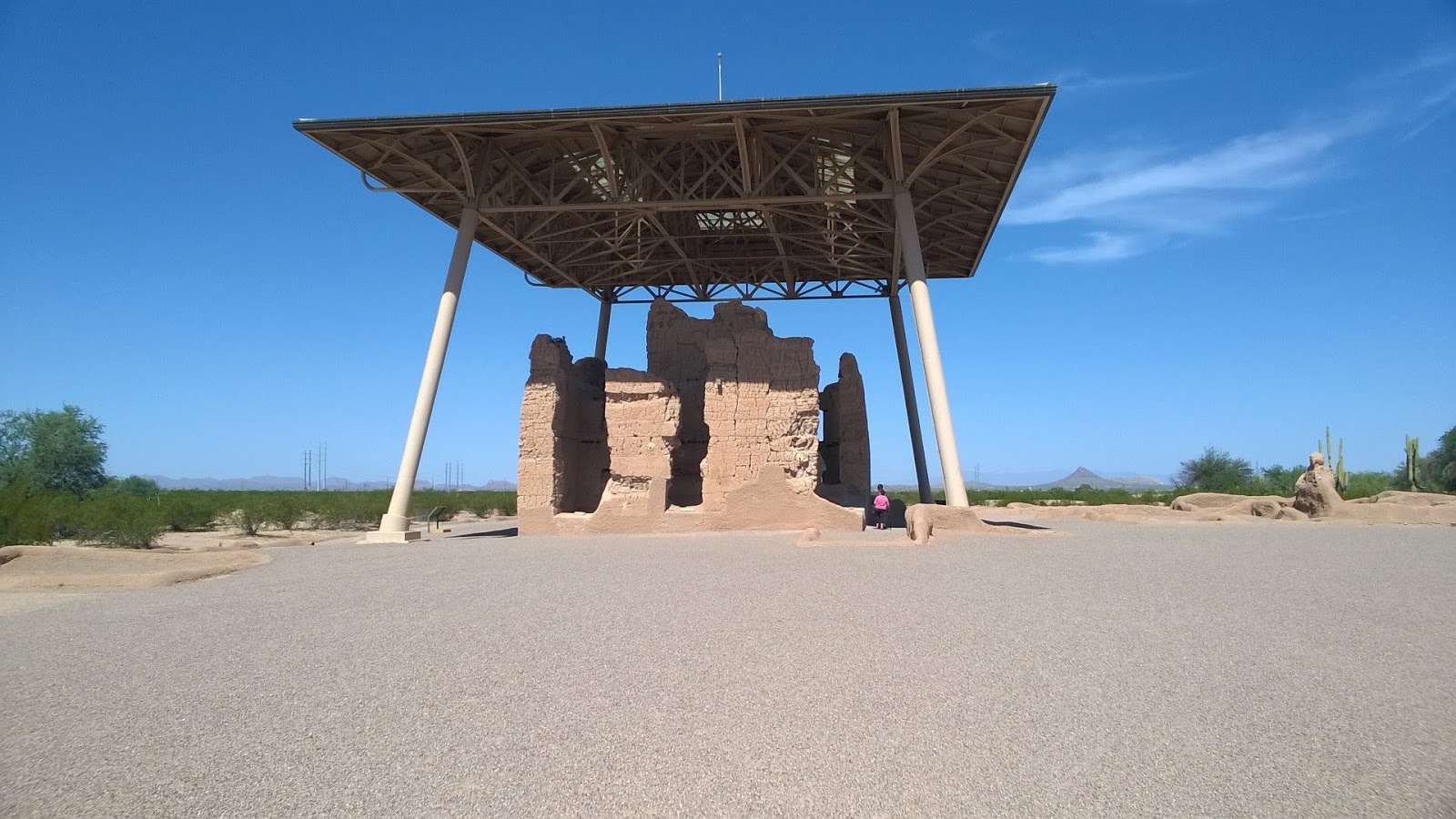
I'm catching up on some places we visited last winter.  The first of which is Casa Grande Ruins National Monument in Coolidge, AZ.  It is a two story great house standing tall and proud in the middle of a large, open area of cacti and other local plants.  There are some other smaller units surrounding it. It was constructed in the 1400s by the ancestral Sonoran Desert people.  These people developed wide-scale irrigation farming, which is still being used in Coolidge today.  The great house is now covered by a modern roof to protect the structure from the harsh sun and monsoon rains.